Jakarta UHI Spatiotemporal Modeling
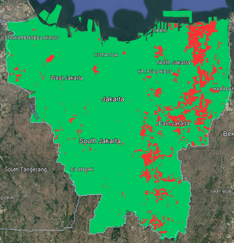
This project analyzes the Urban Heat Island (UHI) phenomenon in Mainland Jakarta using multi-year Landsat Level-2 satellite imagery and machine learning. Land Surface Temperature (LST) was derived alongside NDVI, NDBI, elevation, and distance-to-road features. A Random Forest regression model with per-year Z-score normalization was trained on historical data (2013–2021) and evaluated on 2023 data to predict surface temperature patterns. The model was then used to forecast LST and UHI hotspots for the year 2030. Outputs include spatial hotspot maps, temporal statistics, hotspot movement trajectories, and Google Earth–ready raster visualizations to support urban climate analysis and planning.
Tech Stack
Landsat Remote SensingPythonrasterio
Skills Utilized
Spatiotemporal Data AnalysisSatellite Image Processing
 View on GitHub